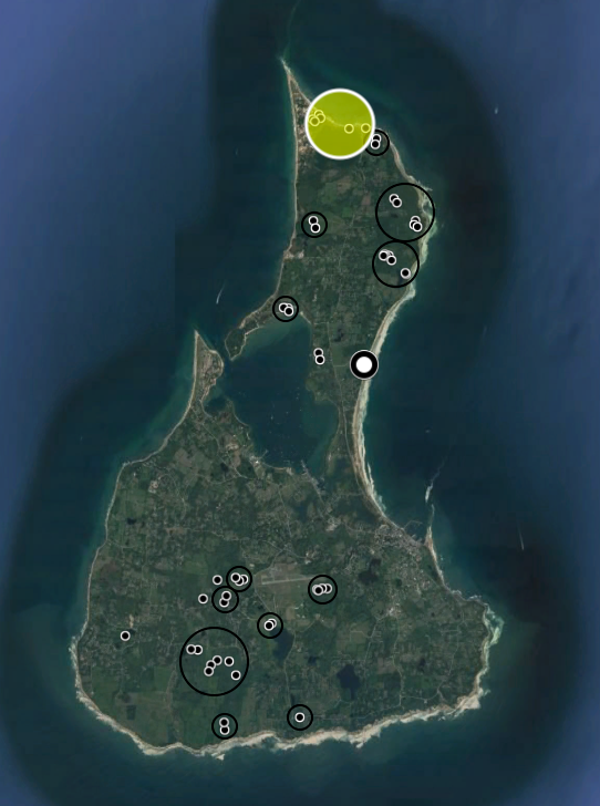
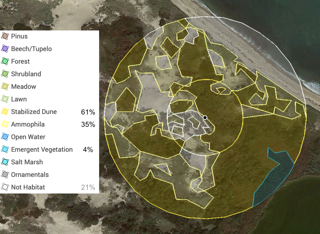
Figure 1. Map of Block Island with survey sites and areas and the Sandy Point / Sachem Pond survey area highlighted.Figure 2. Land cover analysis of Sandy Point within 150′ and 400′ of a point near the center of the four locations of two sheets 14 August 2018 and 7 June 2019. Percent cover values are for within 400′ and exclude non-habitat cover. Starting in 2020, I have surveyed a location to the east on the narrow strip of land on the north shore of Sachem Pond due to greater ease of access.